San Francisco Bay Area
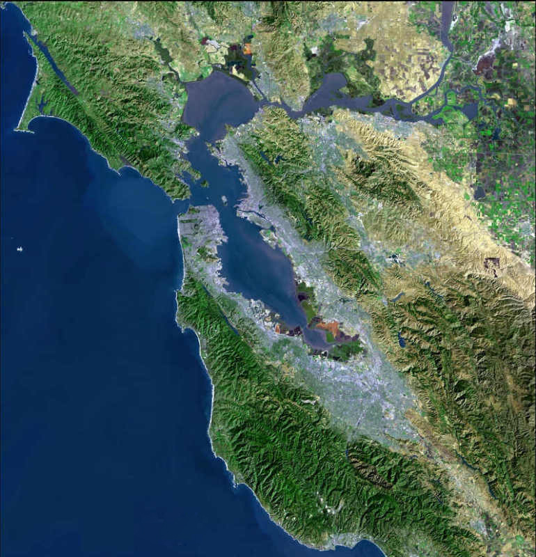
Photo courtesy of the U.S. Geological Survey
Some information relevant to the Bay area as a whole or to large parts of it.
Articles and Links
- Critical Linkages species-based priority landscape linkages - maps and other resources from SC Wildlands
...link
- Ecology of the San Francisco Estuary.
...link
- Bay Area Important Bird Areas and Audubon Chapters, created by Golden Gate Audubon
...link
- San Francisco Bay National Wildlife Refuge Complex is a collection of seven National Wildlife Refuges - Antioch Dunes National Wildlife Refuge, Don Edwards San Francisco Bay National Wildlife Refuge, Ellicott Slough National Wildlife Refuge, Farallon National Wildlife Refuge, Marin Islands National Wildlife Refuge, Salinas River National Wildlife Refuge, and San Pablo Bay National Wildlife Refuge.
...link
- SIMoN (Sanctuary Integrated Monitoring Network), a very comprehensive site covering the Northern California National Marine Sanctuaries which include Cordell Bank, Gulf of the Farallones and Monterey Bay. There are maps, lists of species and other resources.
...link
- San Francisco Bay Trail Project - proposed 500 mile network of trails that, when complete, will encircle San Francisco and San Pablo Bays.
...link
- Bay Area Ridge Trail - ultimately to be a 550+ mile trail encircling the San Francisco Bay along the ridge tops. 310 miles are available now.
...link
- Salt Pond Salt Pond Restoration Project Maps. Many detailed maps of salt pond areas around the bay.
...link
- Guide to San Francisco Bay Area Creeks by the Oakland Museum of California. Includes interactive maps, guided tours, and many fascinating tidbits of information.
...link
- Bay Area Aquatic Resource Inventory (BAARI) - a highly detailed base map of the Bay Area's aquatic features that includes all wetlands, open water, streams, ditches, tidal marshes and flats, and riparian areas.
...link
|